an illustrated map book of hawai’i
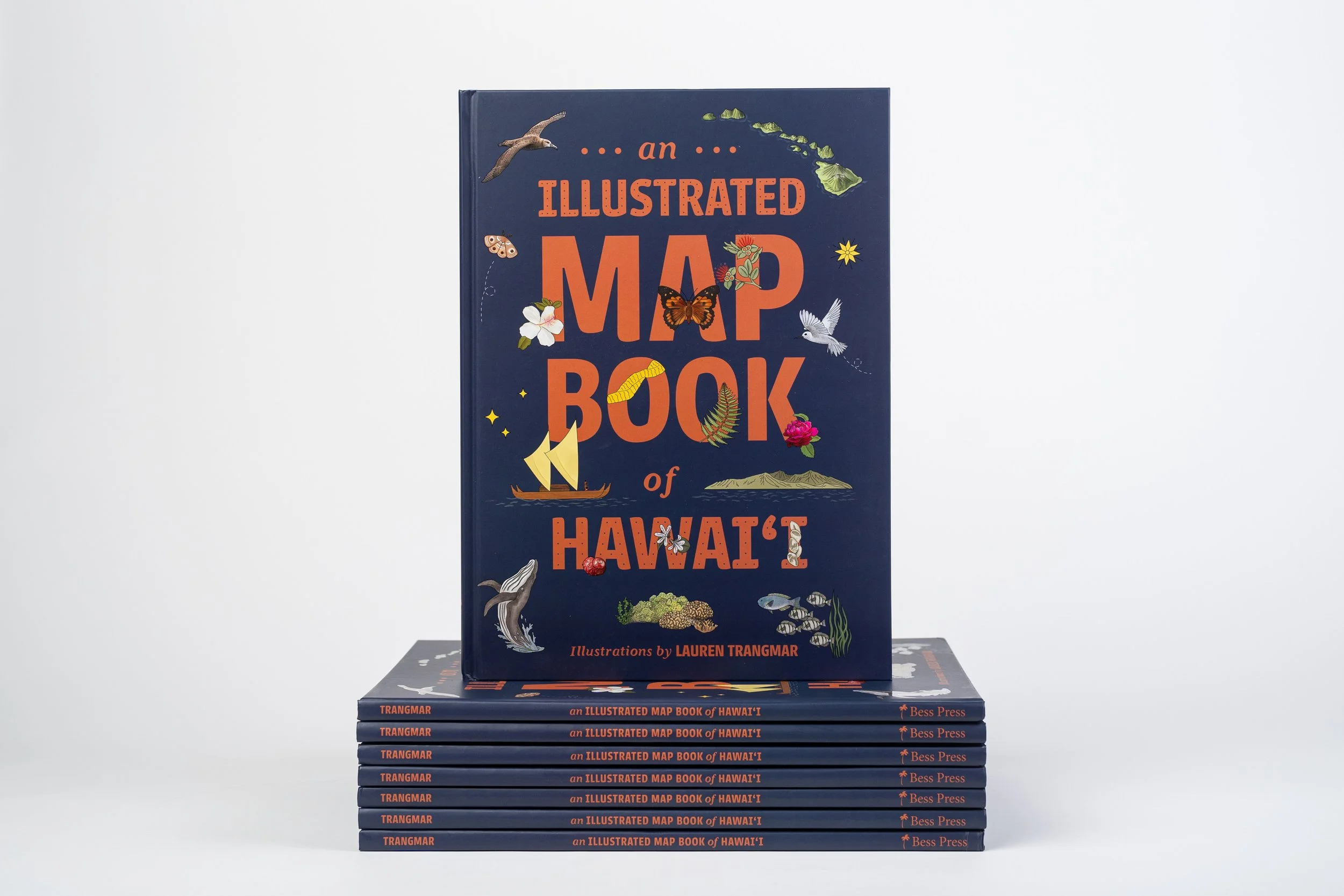
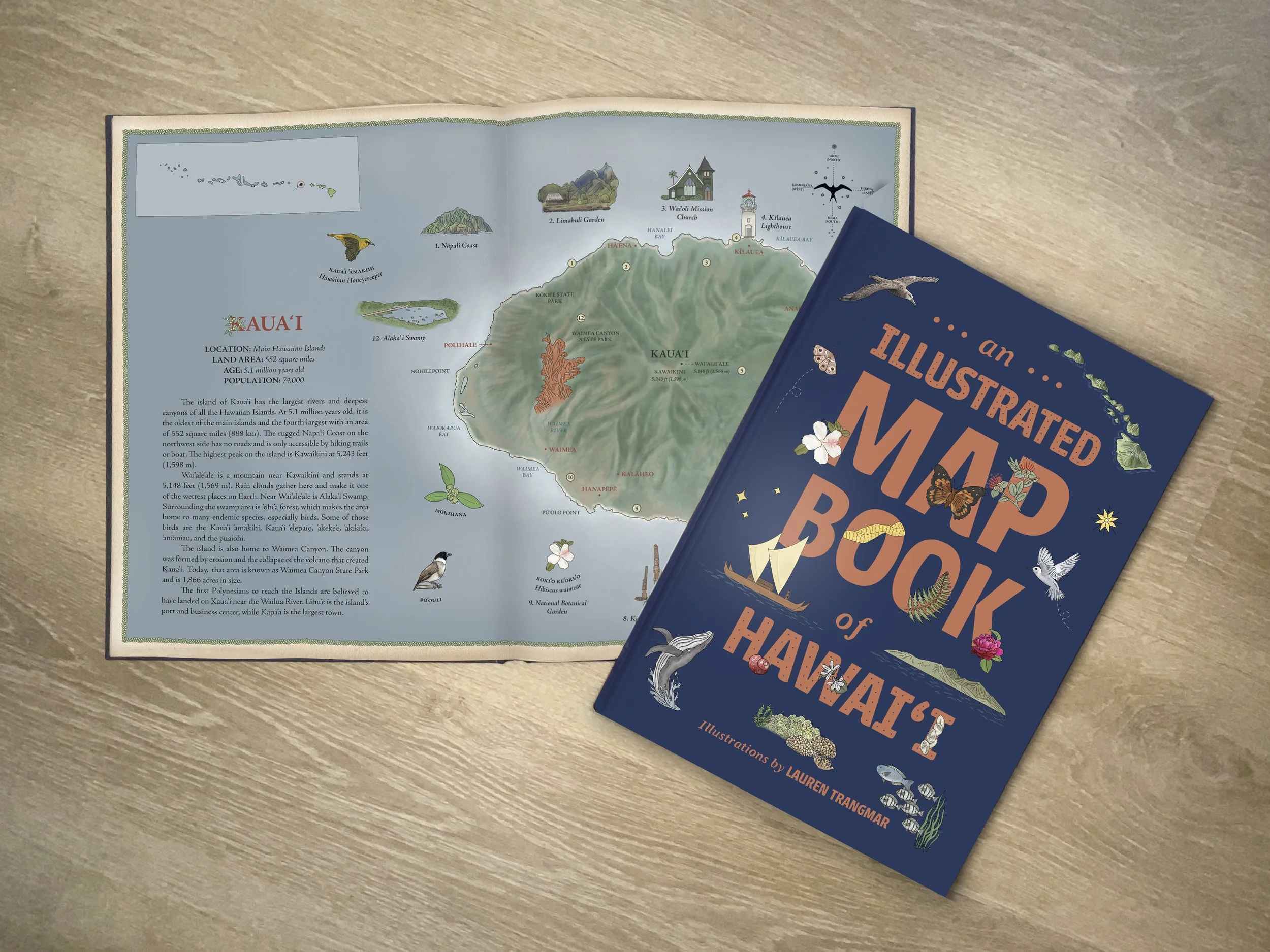

In collaboration with Bess Press, ‘An Illustrated Map Book of Hawai’i’ is a book of maps that represents the islands and atolls of the Hawaiian archipelago. Through detailed illustrations, readers can experience the amazing flora, fauna, and marine species that live amongst these isolated lands and waters, many of which are rarely seen.
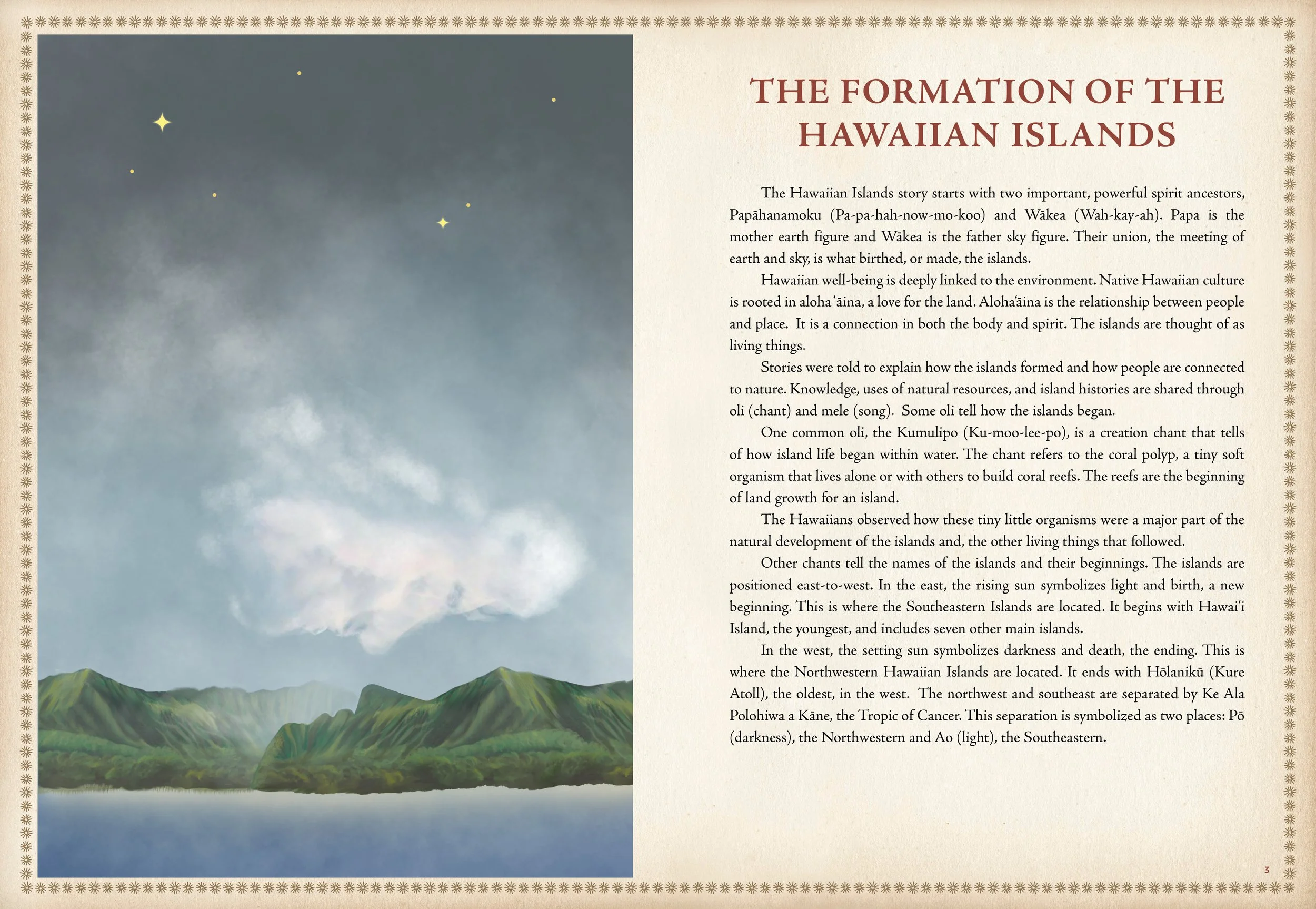
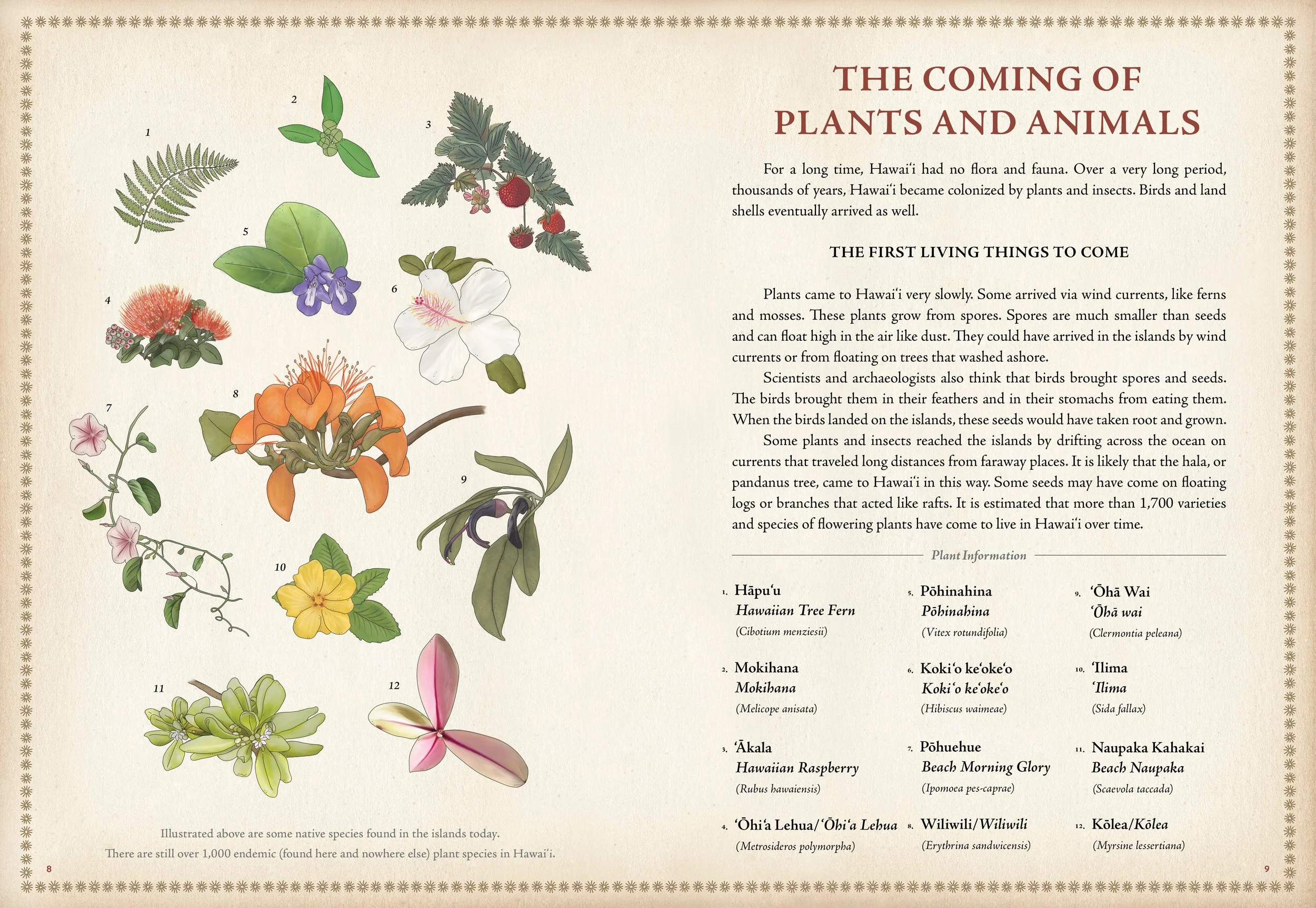
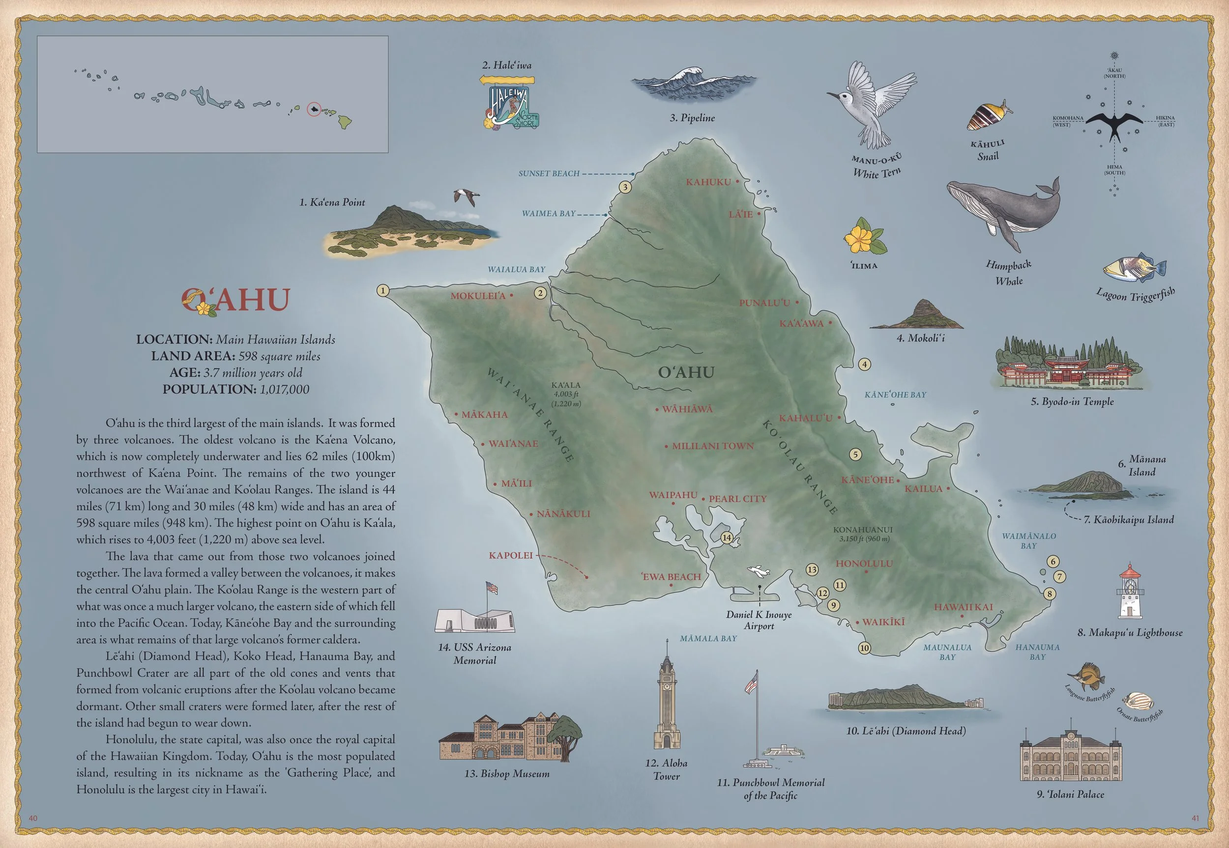
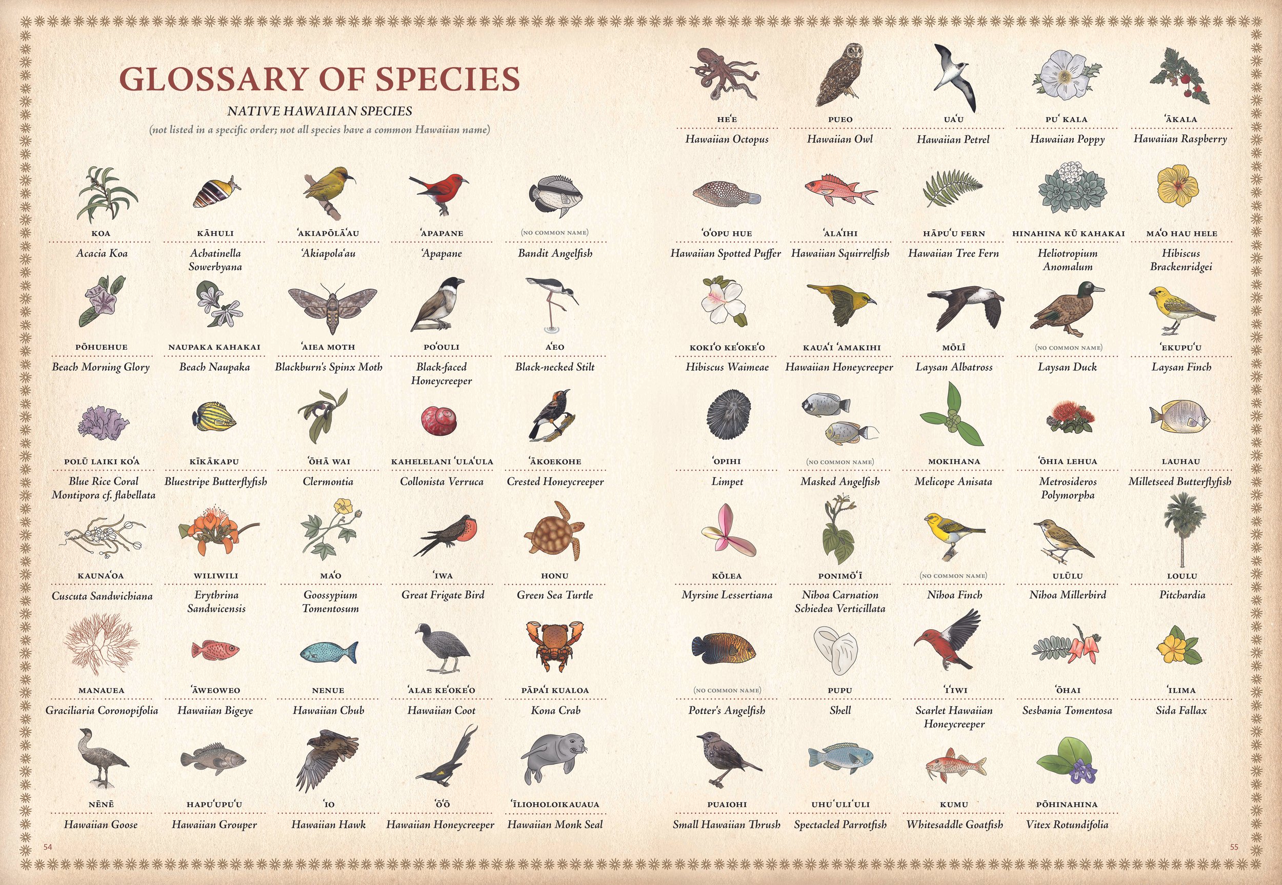
The distinctive and colorful drawings depict these historic Islands from the northernmost atoll, Hōlanikū (Kure), to the southernmost island of Hawai'i. Along with each place, readers will learn about the fascinating geological features and see the native and indigenous species that make this one of the planet’s most remote and biologically diverse regions on Earth!
Available in-store and online at DaShop by Bess Press and various stores that carry my work in Hawai’i.
Photographs by Sean Marrs and Lauren Trangmar