Map of the united states as reported from the hawaiian islands
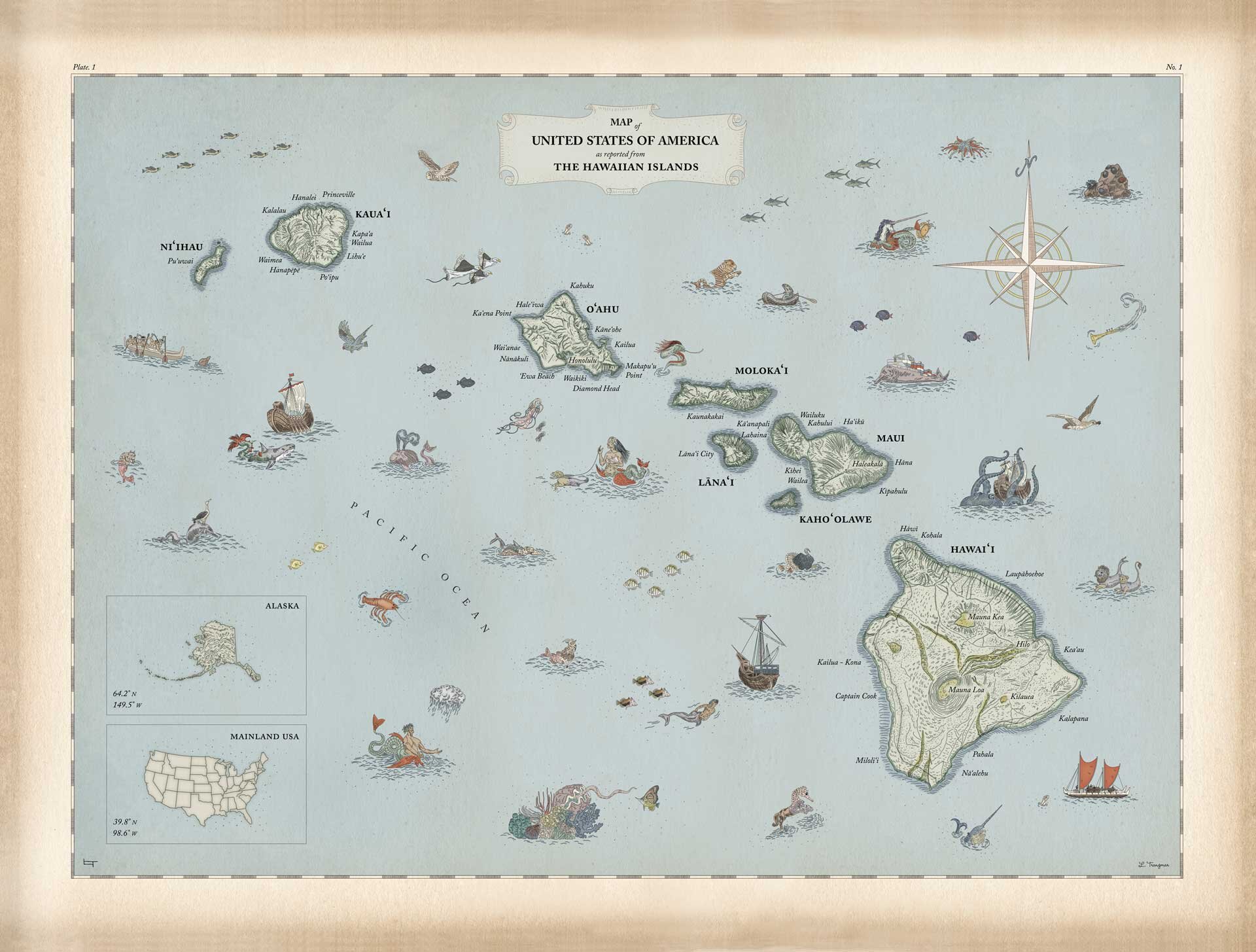
Most maps of the United States are designed from the perspective of the Contiguous United States with the exclusion or diminishment of Alaska and Hawaii. This map reverses the trend by illustrating the Hawaiian Islands as front and center. The map goes further in illustrating a Hawaii centric point of view by including fantastical creatures based on sea life found in the islands and in Hawaiian myths and legends.
This piece (1 of 2) was completed and purchased by a private collector in 2019. 2 of 2 in the edition is available for exhibition.
Materials: Archival pigment ink, ink pen, watercolor, screen print.